ZXS Weather Resources
CURRENT TRENDS
Surface:
VPX (EC compound)
UNBC: current (
Table
) or past week (
Graphic
)
Exploration Place
Otway Nordic Centre
YXS:
Graph
or
METAR
Listing
CMC Surface & Frontal Analysis
UWa
MSLP/IR-Sat Composite
Upper Air:
CMC Analyses:
850,
700,
500,
250 hPa
UWa Analyses/IR-Sat Composites:
500,
300 hPa
ZXS Soundings:
animated,
latest
University of Wyoming:
Sounding Database
Release Imagery
XPG Radar
GOES-West (IR+Vis)
GOES-West (IR only)
Lightning
FORECASTS
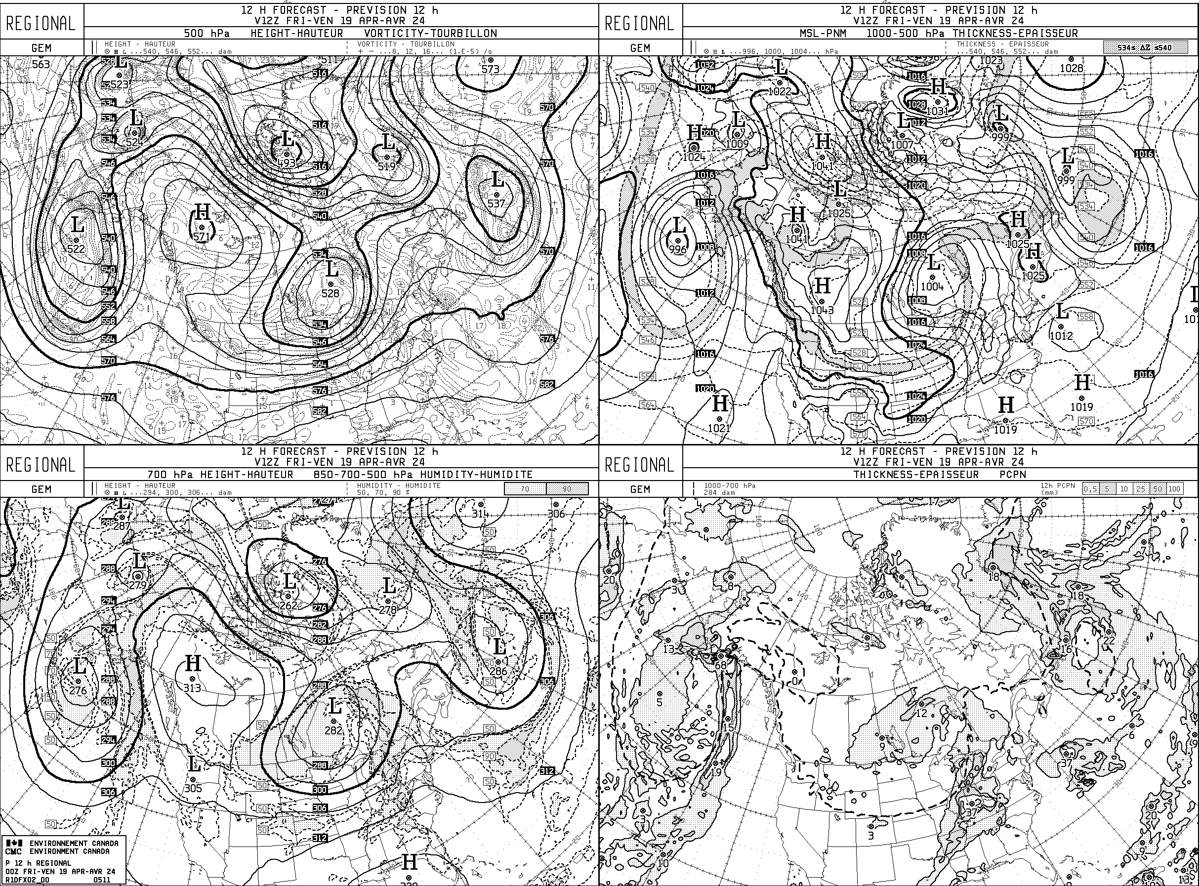
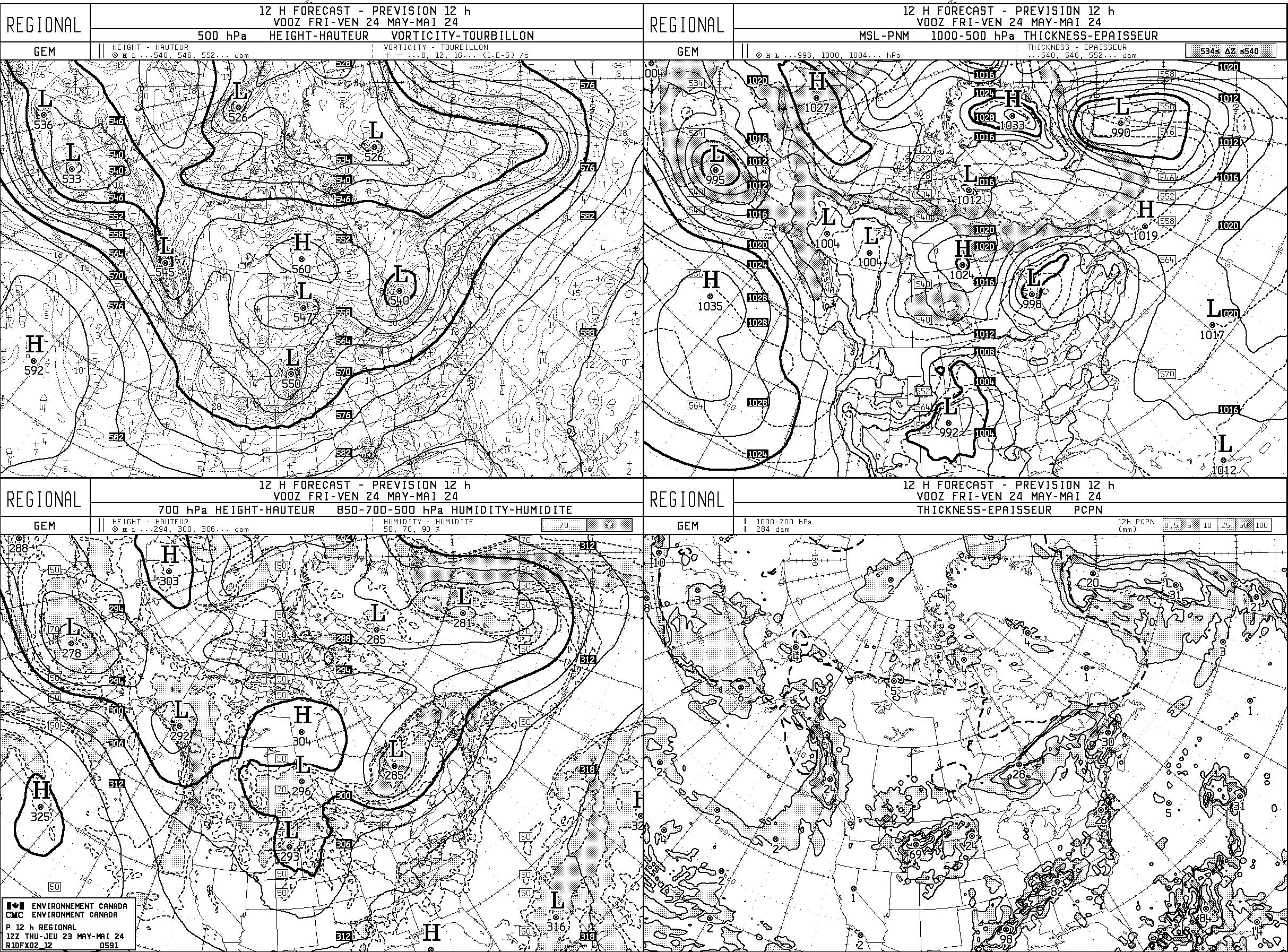
ECCC 4-Panel Map Forecast: CMC Regional GEM
forecast valid for 12Z observation
forecast valid for 00Z observation
ECCC Graphical Time-Series Forecast: via SpotWx @ ZXS
HRDPS 2-Day / 2.5 km resolution /
1 km resolution (experimental)
RPDS 3-Day / 10 km resolution
GDPS 10-Day / 25 km resolution
Text/Icon Forecast: Environment Canada
Central-Interior
Prince George
Avalanche Canada
Mountain Weather Forecast (winter)
Numerical Weather Prediction (NWP) Model Output
UWa Pacific Northwest Environmental Forecasts
UBC Ensemble Forecast Products
ECCC HRDPS 1-km (Experimental)
NWP Model Visualization Tools
SpotWx (meteograms)
Windy.com (2D animations)
Earth (2D animations)
up
home